
Visit Huddart Park
Park Overview
Huddart Park opens daily at 8:00 A.M. including all holidays.
The closing time varies depending on the season.
Address: 1100 Kings Mountain Road, Woodside, CA 94062
Acres: 973
Miles of Trails: 24 Description and Trail Maps
Elevation: 550-2000 ft.
Parking: $6
Restrooms: Yes
Picnic Facilities: Yes Reservation Information
Limitations: No pets or smoking. Cycling on designated trails only.
For current closures and conditions, go to the San Mateo County Parks advisory site.


Download the Huddart Park Brochure
Huddart Park Map
Local Flora
Huddart and Wunderlich Parks are situated in the biologically diverse Santa Cruz Mountains. Ecosystems largely consist of Redwood and Oak Woodland forests, riparian corridors, chaparral, and grasslands. Below are some of the flora (plants) that can be found in these parks.

-
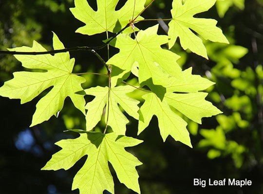
Big Leaf Maple
California Black Oak
California Bay Laurel
California Buckeye
Interior Live Oak
Douglas Fir
Hazelnut
Madrone
Coast Redwood
Tanoak
-
Blue-eyed Grass
California Poppy
Crane’s Bill
Hound’s Tongue
Milk Maid
Miner’s Lettuce
Shooting Star
Soap Root
Trillium


-
California Blackberry
Ceanothus
Chamise
Chaparral Pea
Coffee Berry
Coyote Bush
Manzanita
Poison Oak
Sticky Monkey Flower
Toyon
Wood Rose
Yerba Santa
-
Bedstraw
Bunch Grass
Rattlesnake Grass
Wild Blue Rye
Wild Oat
-
Chanterelle Mushroom
Death Cap Mushroom
-
Fiddlehead Fern
Coastal Wood Fern
Bracken Fern
Five Finger Fern
Golden Back Fern
Maiden Hair Fern
Sword Fern


Local Fauna
Below are some of the fauna (animals) that can be found in Huddart and Wunderlich Parks.


-
Big Brown Bat
Black-tailed Deer
Bobcat
Brush Rabbit
Coyote
Western Gray Squirrel
Mountain Lion
Common Opossum
Raccoon
Striped Skunk
Dusky Footed Wood Rat
-
Acorn Woodpecker
Stellar Jay
California Quail
Chestnut-backed Chickadee
Common Crow
Great Horned Owl
Dark-eyed Junco
Red Tailed Hawk
Scrub Jay
Turkey Vulture


-
Northern Alligator Lizard
California Slender Salamander
Coast Garter Snake
Pacific Gopher Snake
Newt
Western Fence Lizard
-
Banana Slug
Bumble Bee
Centipede
Grasshopper
Hover Fly
Orb Spider
Scorpion
Tarantula
Trap Door Spider
Turret Spider
Wasp
Water Strider
Yellow Jacket

History of Huddart Park
Before the redwoods were logged out, before the Mexican Governor gave land grants to ranchers, and before the padres built the missions and the Spanish explorers claimed California for themselves, Native Americans thrived for centuries among the hills and gorges we now call Huddart Park.
Known by various names, depending on which tribe they belonged to, the Native Americans lived as hunters-gatherers of the abundant resources the land and water provided. They lived in concert with grizzly bears (now extinct locally), mountain lions, deer, coyotes plus many other species and carefully used them to their advantage along with the rich diversity of plant life. The last Native Americans known to be living in the local hills were spotted in 1857. Most had been converted by the Spanish missionaries some 75 years previously and were living near the Missions. Unfortunately, the Spanish brought not only European religion but also tuberculosis and small pox that many Native Americans could not withstand.
-
In August 1840, the Mexican Governor of California granted the land, later called Rancho Canada de Raymundo, to John Coppinger, an Irishman who had become a naturalized Mexican citizen. This 12,545-acre Rancho contained the 973 acres, which are now Huddart Park.
In 1850, the California Gold Rush was booming, and the demand for lumber to build San Francisco resulted in extensive logging operations in the rancho area. Near the present borders of the Park, five sawmills operated between 1853 and 1860. Richard's sawmill, built in 1853, operated just outside the present park boundary west of Skyline Boulevard. From this mill, Richard's Road led down the mountain. Wagons loaded with lumber and drawn by teams of oxen traveled down it towards Redwood City, where the lumber was barged to San Francisco. Today, Richard's Road Trail follows the route of this old road.
James Huddart was a wealthy San Francisco lumberman and long-time resident of Woodside. He was raised in an orphanage with his sister and apparently spent a rather miserable youth there. As a result, Huddart had a deep desire to use his holdings in San Mateo County do something beneficial for the youth in the area.
Before his death in 1935, Huddart deeded 900 acres of his property to the County of San Francisco with the provision that it would be accepted and developed into a public park. Due to water rights problems along Squealer Gulch Creek, San Francisco held it only two years. When the State of California also had problems with the water rights, the property was willed to the County of San Mateo, who has owned and operated the land as a public park since 1944.
In the hundred years since the Huddart Park area was logged, a new forest of redwoods and other trees have grown, covering much of the evidence of this early logging activity. However, still visible are large stumps of the virgin redwoods and "skid roads" over which the teams of oxen dragged logs to the sawmills.

Equestrian Information
Huddart Park, though known for family outings and holiday barbecues, has a lot to offer the hiker and equestrian.
Huddart Park is a shady, creek-side gem with year-round, all-weather trails, picnic areas and restrooms with tie racks. There's ride-in access from surrounding Woodside Trails plus limited trailer parking access off Kings Mountain Rd. Many hillside trails make for great conditioning rides on single-track loops, while Richard’s Road—with its wider track, long sight-lines and more gradual elevation—provides a wonderful opportunity for a safe trot/canter hack.
For up-to-date information about trail accessibility for horse riding at Huddart Park, go to the San Mateo County Parks trails site and filter by Park and Usage.
For current closures and conditions go to the San Mateo County Parks advisory site.
Trail Use Guidelines
Visitors are required to stay on the marked trails, especially when riding horses, and particularly in the open meadow and grassland areas where endangered plants and animals may exist. Please respect your fellow trail users and follow the guidelines for safe and courteous trail use.
When passing horses on trails stop and yield enough space to pass safely – this may require stepping off a single-track trail.
Do not run or jump near horses – especially from behind – announce your presence from a distance as you approach by simply saying, "Hello" or "I'm here." Runners must stop for horses.
Hikers with backpacks, large hats, walking sticks, strollers and large groups may confuse or excite horses. Again, speak to the rider so the horse recognizes you're not a threat, then follow the rider’s instructions.
Equestrians must ride safely, courteously and pass all trail users at a walking pace.